Open Source Software for Tackling Urban Issues
Edited on
04 November 2020An agency that takes care of vacant houses depends on reliable data. Where are the buildings? What data is available? How can an agency make use of them?
Vitaly Matveev, who is now studying for his Master's degree at Vrije Universiteit Brussel (Master of Urban Studies program) and who did a two-month internship at ALT/BAU partner Eriges in Seraing, reports on his experiences with free software programs for surveys. Article by Vitaly Matveev & Sabine Hausmann

Initial situation regarding GIS
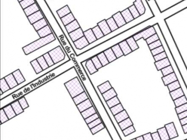
Eriges had done their empty housing inventory 2019 in the traditional way (notebook and pen) with the building data entered manually into the GIS system. When Vitaly started his internship in January 2020 he saw a lot of inconsistencies in the data material. During his internship at Eriges, Vitaly discovered that the general knowledge about the wide-ranging capabilities of Geographic Information System (GIS) was limited. For this reason, along with other project-related tasks, he prepared a series of workshops using the desktop application "QGIS" for interested colleagues.
The aim of these workshops was to discover what can be accomplished with the GIS program. But the profound and highly useful capabilities of GIS will be described in a later article at this page.
Useful methodologies
Another aim of the workshops was to use free tools to be able to perform the most common geospatial analyses with accompanying cartographic visual aids. Inventory methodologies that would be useful to the ALT/BAU network can include (but are not limited to):
- Estimation of approximate building surfaces based on aerial imagery or on vector shapes of the building footprints.
- Calculation of total surface use based on the number of floors and on the building footprint.
- Development of vacancy tax projections based on variable municipal criteria (in the case of Seraing tax is calculated by taking the façade length and multiplying it by the number of inhabitable floors).
- visual categorisation of empty buildings
- updating inventories by using the INPUT mobile app
For Vitaly, the last point in the list deserved more attention.
Which freeware app is suitable for surveys? Using the example of "INPUT"
As with the above mentioned QGIS computer software, INPUT is a free open source application. This means because these products are widely available to any user, they can be customized and while they may lack official technical support, they have a large community of enthusiasts working to improve them. INPUT is an alternative to commercial applications such as ArcGIS, Survey123 and Collector. The INPUT app allows for a seamless integration of new field surveys and updates to the current data via a mobile device to a GIS project created in the QGIS program.
QGIS projects with an inventory can be uploaded to the Mergin cloud server to which other users can connect from their mobile devices via the INPUT app. Users will then have the possibility to access and edit the project layer where they can modify the existing data or add new records to it. Certain restrictions or suggestions can be introduced into the project layer through built-in widgets. This allows data to be more homogenous and easier to aggregate (minimizing human error such as typos or inattentiveness). Widgets are useful for auto-filling the geolocation, date and time of a new record, setting popup menus with selective options or ‘check answer’ buttons.
INPUT also allows the uploading of photos or videos taken from an outdoor survey or phone memory. After synchronizing the project, all collected and updated data is available in the QGIS project on a master computer. This data can then be analyzed, visualized or exported into the desired file formats.


Vitaly Mateev presented the possibilities of free software during an online meeting of the ALT/BAU network and shared his knowledge to acquire building data efficiently with free technologies. These methodologies are just examples of how freely-accessible software can be used to the benefit in a fight against housing vacancy.
The link will take you to his presentation.
"I’m inspired by seeing a vibrant online community developing such open source tools and helping newcomers by giving them advice. I invite everyone to explore these tools, which I found highly useful during my internship, to find new technological solutions to urban problems." Vitaly Matveev, 2020
 Submitted by sabine.hausmann on
