Loures
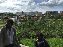
Loures is shaped with hills at the far north that turn softer towards south, up to the “Várzea de Loures”, the large, central and interior floodplain, separated by a line of peaks from the southern and eastern areas, next to Lisbon and the Tejo River. It enjoys a privileged position, with easy road accessibilities both at regional and national levels and major transport infrastructures (airport, railroad and harbour). For the past decades, an accelerated population growth has caused a rapid enlargement of the existing urban centers and the emergence of several new ones. This led to the development of towns and cities not always well fitted for urban life. It also caused a disconnection between urban and rural areas, well shown by the disqualification of the interface areas.
Therefore with its participation in the URBACT implementation network ReGeneration, Loures expects to gather knowledge and best practices to provide adequate urban spaces to be lived and enjoyed by targeted communities; to connect urban centers through rural systems, rich and balanced, as a higher urban quality factor for citizens; to learn how to better interact and involve citizens in projects related to their cities.
SOME RELATED NETWORKS
RU:RBAN
Article
Portugal launches national URBACT-style initiative for networks of ‘circular cities’
Article


