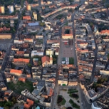
Bytom
Situation
Bytom belongs to the leading municipalities in the field of LIS/GIS because of early (1999/2000) implementa-tion of the latest informatics solutions. Bytom's Spatial Data Infrastructure BIDP - a special kind of geo-warehouse integrating different and independent data-bases - is one of them. The City of Bytom has also ex-perience in developing local plans of land use manage-ment.In consequence of historical conditions, the City of By-tom has a lot of areas which are located between an old historical city center and former settlements con-nected with agriculture which are the city districts nowadays.
Challenge
The economic transformation of Bytom's industry has become a generator of many economic and social prob-lems A degradation of environment and a decrease in the cities' economic base is observedHuge wastelands (260 hectares) have appearedA poor standard of infrastructure and high level of waste and pollution are seen in some areas, like the area along the Strzelców Bytomskich Street
Contribution
To cooperate with the private sector in order to develop strategies and practical recommendations of land use management in respect with all conditions, especially the plans of building the A-1 highway. Setting up of a local development plan for the underde-veloped areas.The terrain situated near old “Powstańców Śląskich” mine will be subject of a Local Development Plan be-cause it is a typical post-mining area where some pro-jects have been started. The Northern ring road, and a part of the A1 motorway are almost finished. After that, the character of this area will have completely changed.
